
Cargo Handling
Facilities
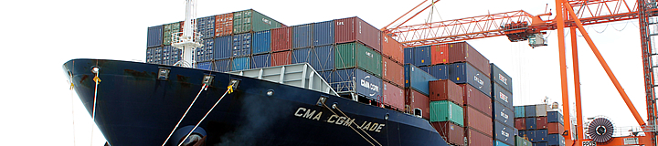
Port of Port of Spain
Type of Port
Multi-purpose
PPOS' Business
-
Cargo Handling - receipt, storage and delivery of cargo including containers, breakbulk, ro-ro- car carrier, one-stop barrel shop, LCL, dry and liquid bulk.
Location
Latitude 10°39’ north, Longitude 61°31.d’west. The port is situated in Port of Spain, capital city of Trinidad and Tobago
Size of Port
Approximately 142 hectares with 61 hectares used specifically for cargo operations
Ownership
Public - 100% government-owned
Number of Berths
Eight
Maximum size of ship
Maximum LOA is 294m ) and Maximum berth draft is 11.5 m
Cargoes
Containerized, break bulk, dry bulk, liquid bulk, ro-ro-car carrier, LCL and barrels
Security
In-house Port Police
STORAGE FACILITIES
FACILITY CAPACITY (sq m)
Shed 3 - Unclaimed Cargo Shed 3,875
Shed 4 -Breakbulk 3,875
Shed 10 - Barrel Shop 6,522
Empty Container Storage Yard 9 hectares
Full Container Storage Area 14.54 hectares
Container Reefer Yard
Vehicle Storage - Car park
Vehicle Storage - Spectrum
Pre arrival information
ETA: Must be sent 24 hours prior to vessel arrival for Deep Sea Calls and 10 hours for Short Sea Calls to the Planning Office ( 623-2901 -4 Ext 261,257,179) via email.
Required documents
Standard Berthing Application - available on the Port's website
Standard messages
Ship arrival and berth availability - sent via email from PPOS to Agent/Line
NOR submission
Vessel arrival information at pilot station and when pratique is complete and operations commence - sent via email from Agent/Line to PPOS
Special regulatory requirements upon vessel arrival
There are several Regulatory Agencies to which vessel per-arrival and departure documentation was be submitted. These include Immigration, Customs, Ministry of Health (Health Office), and Maritime Services Division, Ministry of Agriculture - Plant Quarantine Section
Local Public Holidays
Public holiday note:
Holidays falling on Sunday are observed the following Monday. When two public holidays fall on the same date the following date is also given as a public holiday.
-
Muslim festivals are timed according to local sightings of various phases of the moon and the dates given below are approximations. During the lunar month of Ramadan that precedes Eid al-Fitr, Muslims fast during the day and feast at night and normal business patterns may be interrupted. Some disruption may continue into Eid al-Fitr itself. Eid al-Fitr and Eid al-Adha may last up to several days, depending on the region.
-
Hindu festivals are declared according to local astronomical observations and it is not possible to forecast the date of their occurrence exactly.
2015
Holiday Date
New Year's Day January 1st
Carnival Monday February 16th
Carnival Tuesday February 17th
Spiritual Baptist Shouters' Liberation Day March 30th
Good Friday April 3rd
Easter Monday April 6th
Indian Arrival Day May 30th
Corpus Christi June 4th
Labour Day June 19th
Emancipation Day August 1st
Independence Day August 31st
Republic Day September 24th
Christmas Day December 25th
Boxing Day December 26th
Divali To be Announced
Eid ul Fitr To Be Announced
Navigation
Port Limits
All that area of sea from the eastern bank of the mouth of the Maraval River, to the east of a line bearing 61°15’ from sea and parallel to the centre line of the Grier channel and seaward to a distance of 2.96 nautical miles, to the geographical position latitude 10°38’2” north, longitude 61°34’51” west and thence in a south-easterly direction to latitude 10°36’24” north, longitude 61°032’30” west then due east to the low water mark, on the east by the low water mark of the coastline in the area of the Caroni Swamp and Sea Lots and on the north by the low water mark of Port and IDC lands. Grier channel and basin is dredged to -12m chard datum (CD). The Sea Lots channel is dredged to - 6.7m CD.
Pilot station details
10°32.2’ north, 61°34.5’ west (for vessels less than - 10m draft) and at 10°36.5’north, 61°37’west (for vessels greater than - 10m draft)
Anchorages
Vessels are permitted to anchor two miles from the Port of Port of Spain in the Gulf of Paria outside the entrance of the Grier channel
Charts
Admiralty Chart 484, 482, 483 and TT003
Towage requirements
Towage is not necessary for vessels under 1000 tonnes. Vessels above 1001 tonnes require one tug and vessels between 15,000 tonnes require two
|
Item No |
No of Vessels by Size
|
Standard No. of Tugs Required |
|
1 |
Under 1000 GRT
|
0 Tugs |
|
2 |
1,001 to 10,000 GRT
|
1 Tugs |
|
3 |
10,001 to 20,000 GRT
|
1 or 2 Tugs |
|
4 |
20,001GRT and Over with LOA under 230 m
|
2 Tugs |
|
5 |
20,001 and Over with LOA >230 m and < = 265 m
|
2 Tugs |
|
6 |
20,001 and Over with LOA >265 m and < = 295 m |
2 or 3 Tugs |
Navigational aids
Aids to navigation include paired channel lights and range lights systems. Details are shown in drawing TT003
Tides
One metre difference between high and low tides. The tidal streams follow the coast
Repair and dry docks
No dry dock facilities in the Port. Facilities available at the Caribbean Drydock Ltd, five miles west of Port of Port of Spain. Slipway facility located at the port with capacity for vessels up to 1800 tonnes
Bunkers, provisions and fresh water
Bunker service available on request through local agent. The Port provides fresh water. Provisions available through shipping agents or ship chandlers
Means of water supply
Freshwater is pumped to vessels from quayside hydrants. Bunkers are provided via barges.
Medical facilities
The nearest health clinic is on the Port and is equipped with an ambulance. Other health service providers include Port of Spain general Hospital, St Clair Medical Centre and the Community Hospital Cocorite within radius of the city. The Eric Williams Medical Sciences complex is approximately five miles from the Port.
Airport and transport network
Piarco International Airport is approximately 21 kilometres (13 miles) away, approximately 25 minutes east of the Port. Nearest highway (Churchill Roosevelt Highway) less than a mile from the Port.
Crew changes
Crew changes can take place subject to Customs and Immigration policies and procedures.
BERTH INFORMAITON
|
BERTH |
LENGTH (m) |
DRAFT (m) |
FACILITY |
|
Caricom Jetty |
248 |
4 |
Caricom Cargo |
|
Catwalk (GSS) |
107 |
4 |
Inter- Island Ferry Terminal |
|
St Vincent Jetty |
119 6 |
4 |
Tug and Dredges |
|
Slipway Guide Jetty |
215 |
|
On lease for slipway operations |
|
No 1 |
198 |
8.1 |
Hyatt |
|
No 2 |
152 |
9.2 |
Hyatt |
|
No 3 |
152 |
9.2 |
Passenger |
|
No 4 |
152 |
9.9 |
Multi-Purpose |
|
No 5 |
180 |
10.4 |
Container Terminal |
|
No 6 |
140 |
10.5 |
Container Terminal |
|
No 6A (east) |
170 |
11.5 |
Container Terminal |
|
No 6A (west) |
170 |
11.6 |
Container Terminal |
|
No 7 |
165 |
12 |
Used by UM Bulk Liquids Trinidad Ltd |
|
No 8 |
194 |
9.5 high water |
Used by National Flour Mills Ltd and UM Bulk Liquids Trinidad Ltd |
|
No 8A (west) |
72 |
4 |
Dry Bulk |
General Layout
Berths
|
Berth |
Length (m) |
Draft (m) |
Facility |
|
Caricom Jetty |
248 |
4 |
CARICOM Port |
|
Catwalk (TTIT) |
107 |
4 |
Inter- island ferries |
|
St.Vincent Jetty |
119 |
4 |
Tugs and Dredgers |
|
Slipway Guide Jetty |
215 |
|
On lease for slipway operations |
|
1 |
198 |
8.1 |
Hyatt |
|
2 |
152 |
9.2 |
Hyatt |
|
3 |
161 |
9.2 |
Passenger |
|
4 |
161 |
9.9 |
Multi- Purpose |
|
5 |
161 |
10.4 |
Container terminal |
|
6 |
181 |
10.5 |
Container terminal |
|
6 A East |
128 |
11.5 |
Container terminal |
|
6 A West |
169 |
11.6 |
Container terminal |
|
7 |
217 |
12 |
Used by UM Bulk Liquids Trinidad Ltd |
|
8 |
168 |
9.5 high water |
Used by National Flour Mills and Used by UM Bulk Liquids Trinidad Ltd |
|
|
|
|
|
Channel
|
Length |
Width |
Depth |
|
8.5 Km |
122 m |
11.4 m |
Turning Basin: 540 m diameter
Anchorage area: 2 nautical miles from the entrance of the channel
Working Hours
Monday to Sunday - 24 hours a day. Weekend and public holidays - overtime rates applicable. Caricom Wharves: Monday to Friday 0700-2300 hours, additional hours at overtime rates. Office hours Monday to Friday 0800-1600 hours. Shed 10 (Barrel Shop): Monday to Friday 0700-1600 hours, additional hours at overtime rates.
Pollution
The newly founded Harbour Control Department, that is responsible for the seaside area and the interface area with the landside also manages marine pollution problems e.g. oil spills .They are assisted by the National Oil Spill Contingency Plan.
In This Section
Tools
-
Login and Track Your Container
Need Help with NAVIS?
Container ISO Codes - Frequently Asked Questions
All you need to know about doing business at the port.
- Interactive Port Tour
Take an Interactive Tour of the Port
Quicklinks
- HSE Online Orientation
- Expression of Interest Request for PPP
- Application Forms
- Tenders
- Bulletins
- Port Statistics (PPOS)
- Tariffs (POSINCO)
- Tariffs (PPOS)
- Breakbulk Charges
- Cruise Ship Arrival Schedule
- Employment Vacancies
- Media Releases
- Inter-Island Ferry Schedule
- Shipping Lines and Agents
- Port Codes
- Glossary of Maritime Terms